
First Officer's Log Days 8-10, Utah Expedition
This is the third in a series of posts about our recent trip to Utah
USS Puma Palace - First Officer's Log
6.10.2015 Expedition Day 8
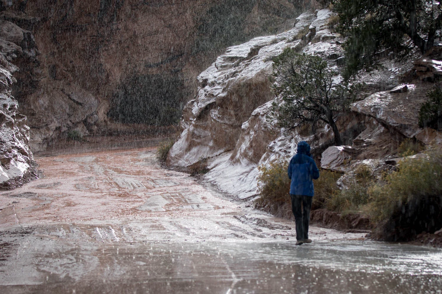
Moved bivouac to Capitol Reef. This included crossing several interesting geological features. One feature was a series of white sandstone hummocks that dipped down to the Escalante River. Possibly this was Escalante sandstone, however we do not have a geologist attached to our expedition so we are unsure if this is correct. Then we climbed to the top of a 9600 foot summit. Informational signs stated the road was not paved until approximately 28 years B.P. Fortunately drive was relatively short and we were able to arrive early at our planned site in the historical district of Fruita. This is a popular campground and filled before noon, within an hour of our arrival. Weather is threatening but no rain during camp set up amongst the pome and pit fruit orchards. Drove the main paved road south from the camp to Capitol Gorge where it rained. Observed flashy nature of local runoff channels. Meager amount of precipitation resulted in runoff that covered road in low spots. We returned to the main area of human activity and made sunset images from Sunset Point. This was a busy location but we hope to have captured some interesting material as the earlier storms were dissipating.


7.10.2015 Expedition Day 9
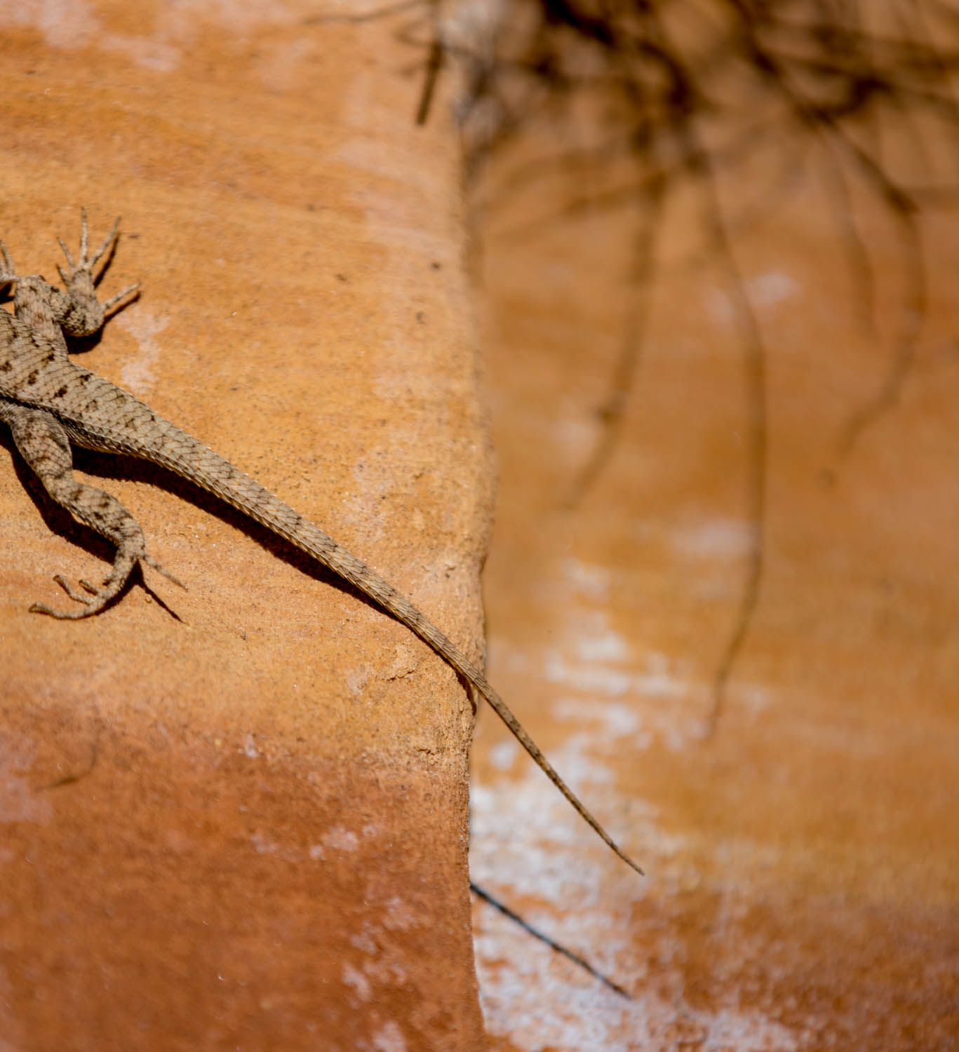
Although we did not arise early, we did arise in time to get low sun-angle photos of the historic district. The Captain was particularly intrigued with the numerous old and discarded farm implements of the “blacksmith” shop. One could surmise that the smith was of quite melanistic coloring. This would be incorrect. Apparently the lack of light in the smithy leads to the name “blacksmith”. Or this could be a reference to the black walls and ceiling from inadequate pollution control and ventilation. We also visited a building where local baked goods were being hawked. The cherry pie was excellent; the cinnamon roll relatively large and very good also. The main task for the morning was a recon of the Notom-Bullfrog road down to Park Boundary. We had received intelligence that this was a suitable location for sunrise images. This seemed reasonable given the road is on the east side of the main ridge (reef) that makes up most of this “park”. A walking transect was made approximately ¼ mile up a drainage from this road. Local reptilian and avifauna were observed. No exceptional species were observed. Due to the recent precipitation, the more southern reaches of this road had many wet and muddy spots and turned very sloppy slightly after crossing onto lands managed by “NPS”.


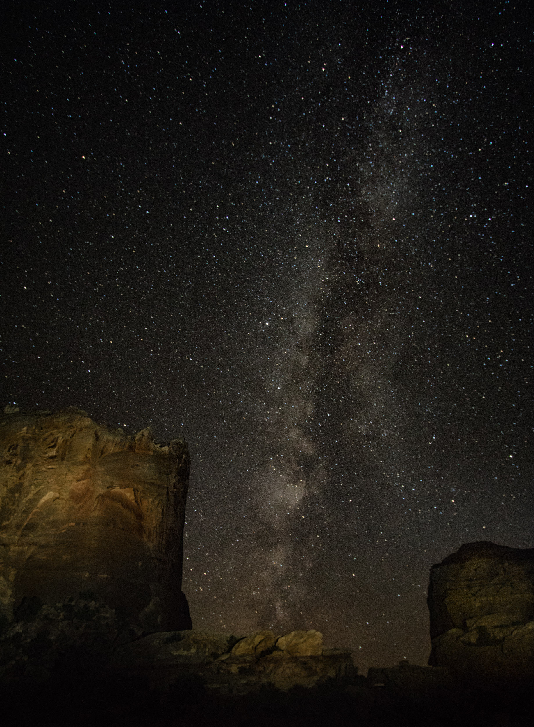
Turned around and hiked up to the Hickman Bridge. Had a near terminal failure on the new imaging support equipment (locally known as “tripod”) when a foot detached from its distal leg segment while being transported to the bridge area. The First Officer backtracked and was unable to locate the missing piece. Fortunately, a fellow traveler located the piece and returned it to the Captain. The First Officer has added regular torque checks to the tripod equipment checklists. The evening was spent with the imaging equipment attempting to align an old barn, the Milky Way, and other pleasing visual elements in the Fruita area. Unfortunately, the local agriculturalists had implemented flood irrigation protocols in the key location the crew had scouted earlier. This turned the optimum imaging location into a lake unsuitable for humans equipped for desert conditions. The crew made the best of the situation but the frustration quotient warning level was elevated.
8.10.2015 Expedition Day 10
Once again the crew returned to Fruita in early morning to photograph old stuff in and around the blacksmith shop. Previous imaging attempts had been determined to be “unsuitable” upon review. Today’s imaging was determined to be “adequate” with maybe a “good” though none in the “exceptional” category. The frustration quotient warning level remains elevated.
Exploration then moved to the Capitol Gorge Road where the crew walked several miles down the canyon. Local administrative unit transportation infrastructure maintainers appeared to be operating equipment ahead of us in an attempt to open the road for city-appropriate vehicles. After considerable time the crew was able to overtake the maintaining machine. (Unknown whether the locals refer to this machine as a ‘grader’, ‘maintainer’, or ‘mud slopper’.) After catching up with the maintaining machine the crew realized a map interpretation error had been made. Our intrepid crew thought a scenic destination was a mere 2 of the local “miles” units down canyon. Upon reaching the vicinity of the maintaining machine, it was realized that the 2 “miles” applied from the end of the road being maintained, not from the location where our power unit “Buzz” had been left in stand-by. The crew then calculated that a moderate walking journey would become an 8-10 mile trek if the crew deployed all the way to the Tanks (our original destination). The crew then returned to “Buzz”. Total deployment length estimated at 5-6 miles. The frustration quotient warning level now at very elevated.
A recon mission was then undertaken down the Grand Wash canyon in anticipation of evening imaging. This area had several areas where uranium oxide had been removed in the hopes of obtaining potentially fissionable uranium. Warning signs strongly suggested we not imbibe the surface water (at less than 3 miles from camp, the First Officer suggested he would rather crawl the 3 miles with two broken tibias, than drink surface water. The First Officer also wondered how the flying mice creatures survive the radiation and toxic gases. The FO was cautioned for impertinence.) The recon determined that the canyon did provide potentially suitable imaging opportunities for combining artificial illumination of the cliff faces and astronomical features. The frustration quotient warning level was reduced to elevated.
Additional imaging exercises were completed upon canyon egress. Sunset images were made at Panorama Point. The crew later evaluated these as having “potential” but certainly did not meet exceptional rating.


After quickly pausing for evening sustenance, the crew returned to Grand Wash to complete the evening image tasking. The crew determined that the photos may reach the “good” level. Post-mission processing will be needed to obtain maximum results.


Log transmission ends. Standby for future log segment...