
First Officer's Log Days 11-13, Utah Expedition
This is the fourth in a series of posts about our recent trip to Utah
Canyon wall along the Burr Trail
9.10.2015 Expedition Day 11
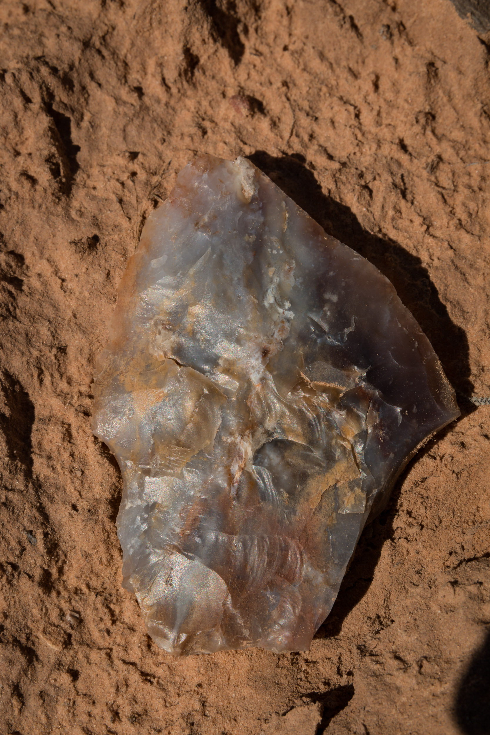
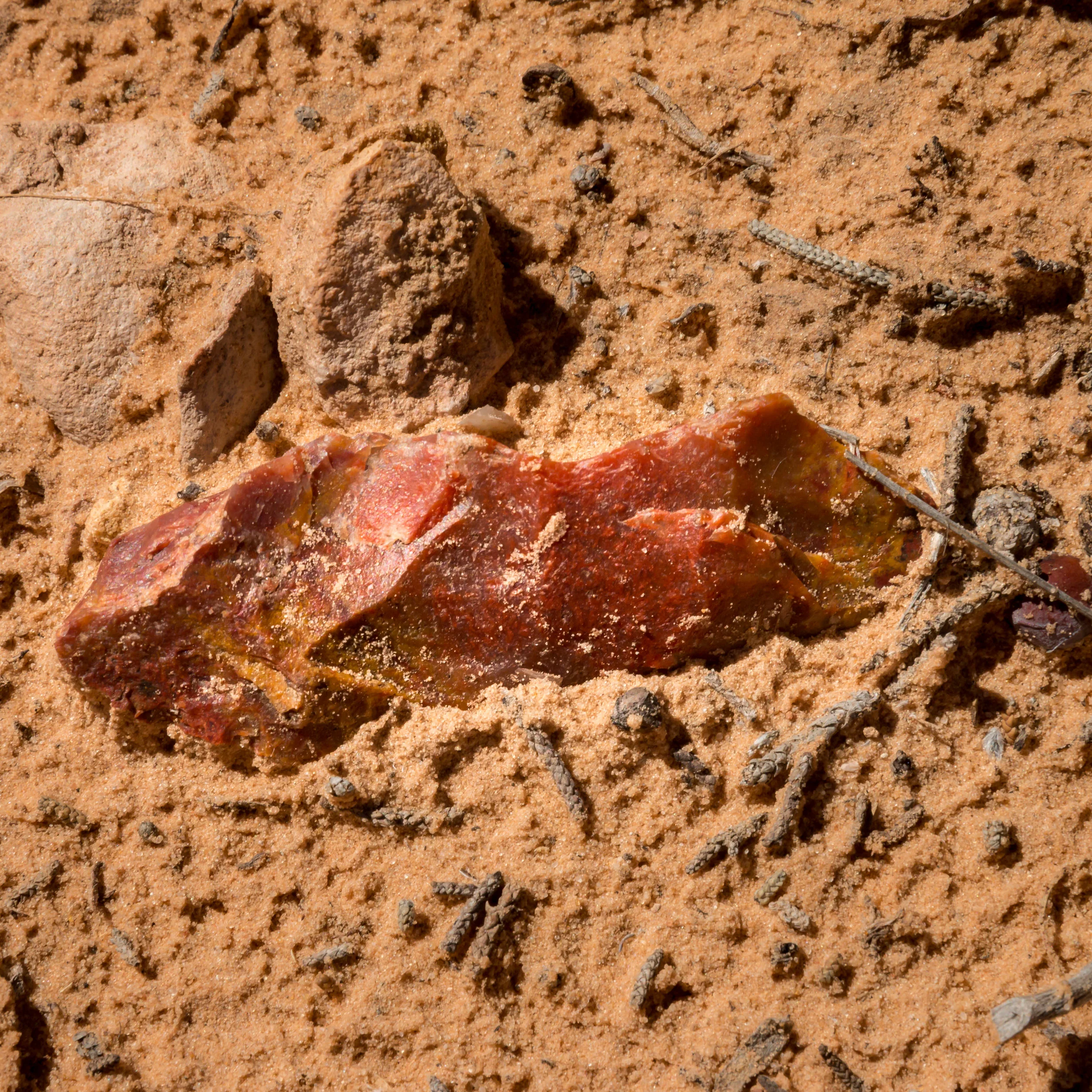
Today’s mission was a long-exploratory journey of the eastern portion of this administrative unit (“Park”). The crew transited the Notom-Bullfrog road to Surprise Canyon and then over the Burr Trail road to Boulder, Utah. During this exploration foot transects were made from the road. The first transect was made walking to the east of road looking at sharp low ridges with fossil bivalves and snail shells. Then transited directly west of the power unit Buzz towards a narrow canyon that could be observed in the middle distance (estimated by the First Officer as 1-1.5 miles linear distance. Captain disputed the estimate, estimating the distance to be much farther west). During this transect one low ridge of multicolored fine grain material was crossed. Then, following a sandy wash to avoid local microbial-enhanced soil crusts, the crew skirted a narrow slot canyon whose bottom was filled with water of undetermined depth and questionable purity. While crossing the hillside above the pool the crew observed early aboriginal spear points and stone tools. Many fragments from aboriginal tool making were also encountered. The Captain posited that the site may have been some form of aboriginal encampment. The First Officer located a nearby site where ungulate tracks from multiple individuals appear to indicate fighting or dominance determination. One track showed the imprint where one animal had been driven to its forelegs. The event was quite recent as the surface had been freshened by the recent rain of 3 days ago. The crew’s working presumption is a fight occurred over herd dominance and breeding privileges. The First Officer also located a mineral lick in same area, much less disturbed then the presumed fight location. These lend credence to the location being very suitable for early aboriginal hunter-gatherers. While returning to Buzz, the crew also noted a possible quarry location for tool material seen earlier. Per Fleet aboriginal observation regulations, all items were left in place. The crew will report these observations to the local administrative unit.


The next walking transect occurred at Surprise Canyon. This is an established trail and leads into a deep narrow canyon. The crew did not travel far into the canyon as time and the ability to meet programmed imaging taskings was becoming an issue. Images were made but lighting was judged as lackluster. The crew did not encounter any “surprises” in this canyon. A strong storm upstream in the canyon could provide a potentially mortal “surprise” in the narrow canyon. But this is not unusual in this area. The crew remains uncertain as to the provenance of the name.
The next travel segment was along the Burr Trail. Trail is a misnomer. Road is more correct. The most eastern section is native material and makes many switchbacks to the top of the ridge forming the Waterpocket Fold. These switchbacks are quite steep and somewhat of an engineering feat given the primitive tools used to engineer and construct the road bed. The Captain found the side slope daunting. The First Officer thought them spectacular. (The First Officer was counseled for lack of safety consciousness.)
The Burr Trail crosses the Waterpocket Fold.
Shortly after the switchback section, the crew decided to delete a side trip to an overlook of the valley that we had spent the day surveying. There was a strong desire to return to the high land of Populus tremuloides (aka aspen, aka twinkly golden leaves) for evening imaging. It appeared that transit times would prevent reaching the Aspen Mountain with sufficient light remaining. Therefore, the planned stop at the valley overlook was cancelled and bumped to a future expedition. Fortunately, as the road changed administrative jurisdiction from NPS to BLM, the road converted to paved.
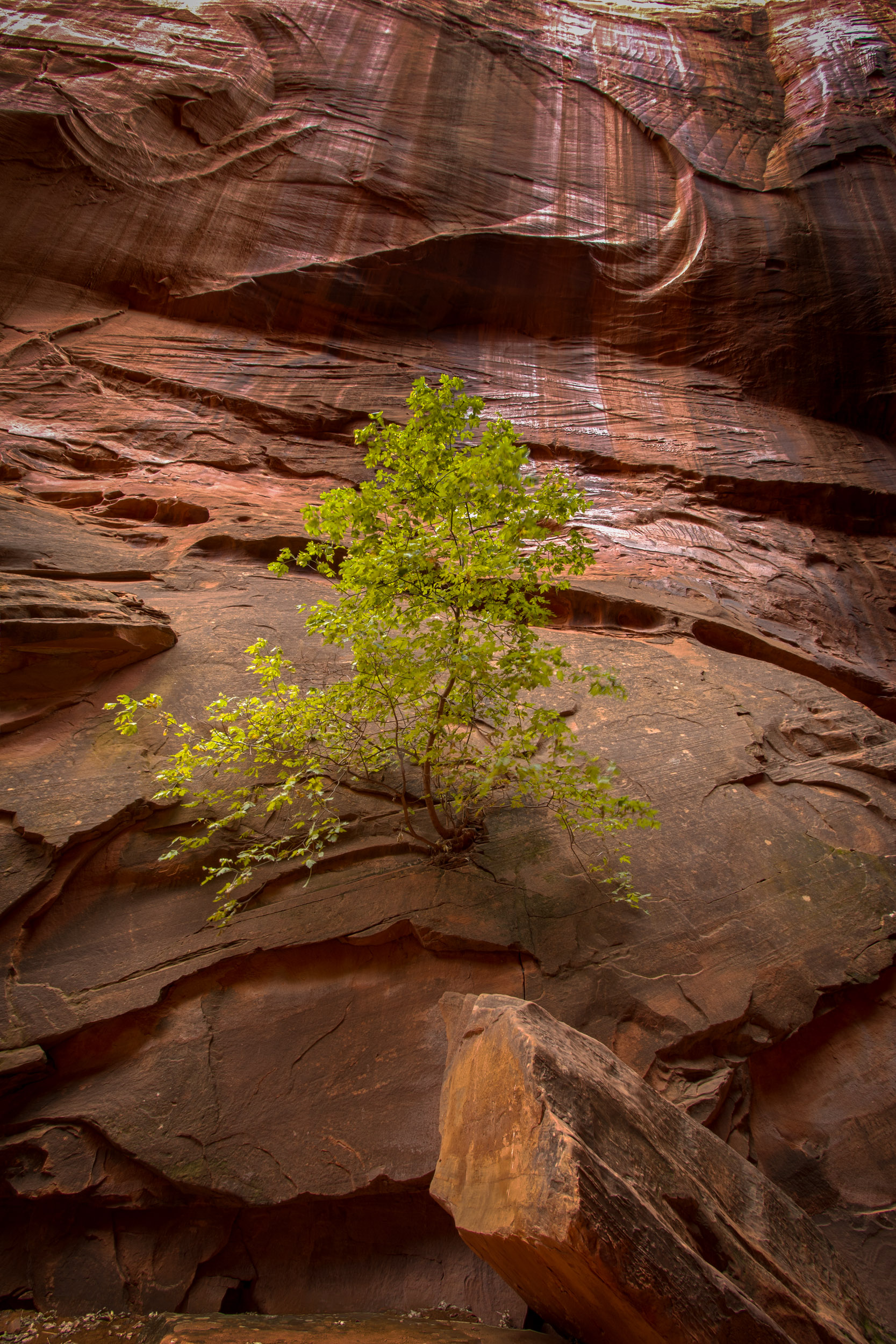
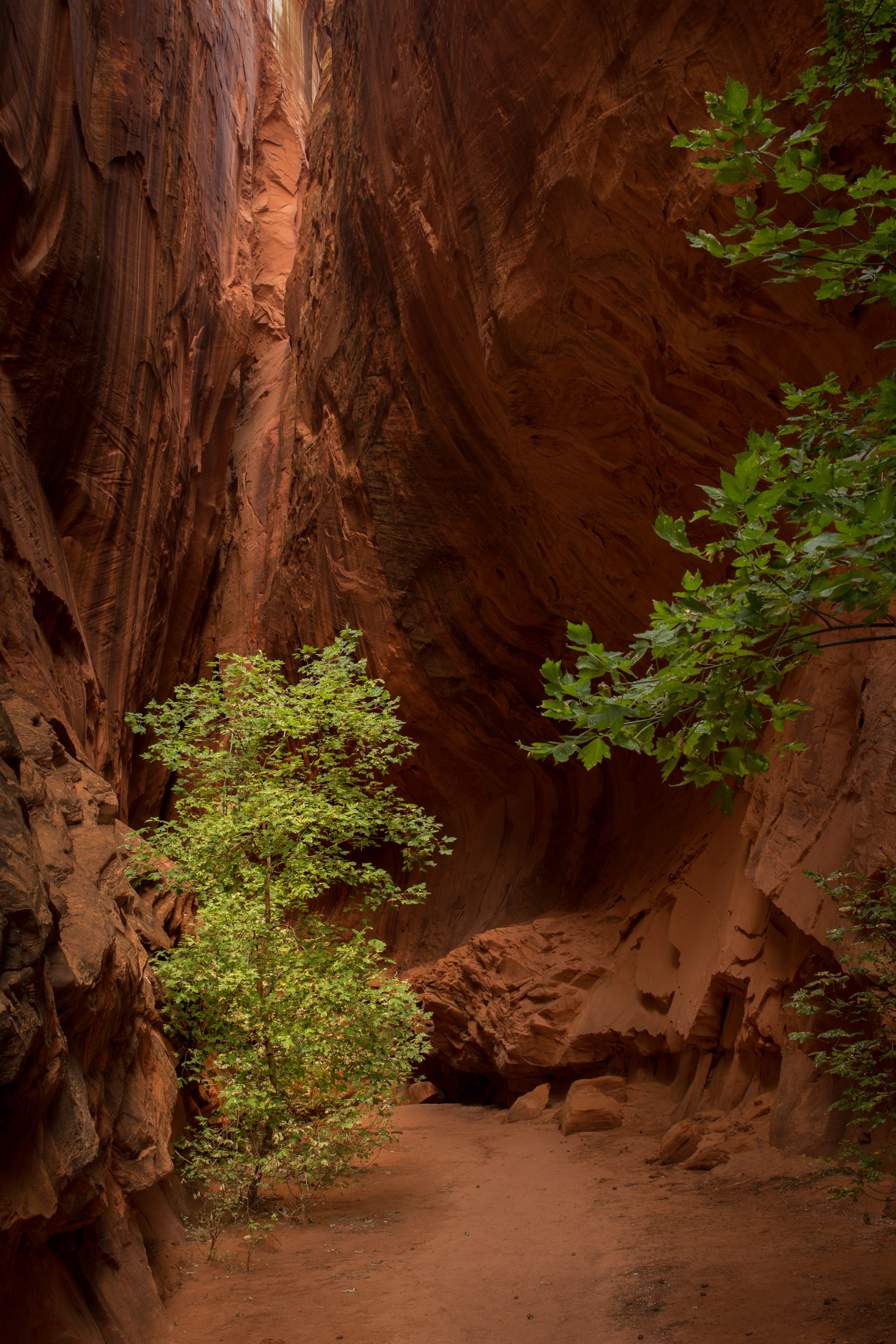
A required bodily function break caused the crew to stop in a canyon adjacent to an extremely large tree known locally as a Cottonwood. Behind this large tree was an extremely pleasant example of a “slot canyon”. Although not particularly long, this slot canyon displayed “nice light” requiring deployment of both sets of imaging equipment. The frustration quotient warning level was reduced to “moderate”.


The Burr Trail eventually connected with a state arterial road at Boulder. We had previously passed along this segment en route to our present bivouac. During today’s return leg from Boulder to camp the crew stopped on Boulder Mountain (9500+ foot elevation) and took aspen pictures in the waning evening light. On the TSS (Turner Sunset Scale) the evening rated a 3.25. The frustration quotient warning level was increased to “elevated”. Arrival at camp was considerably after dark. Very long day, especially in front of an impending departure.


Aspen on Utah 12 (Click on image to enlarge)
10.10.2015 Expedition Day 12
Today the crew moved camp from Capitol Reef to Moab. Today’s primary tasks were logistical: laundry, re-provisioning, and showers that had sufficient pressure to [REDACTED]. After completing our logistical tasks we were able to avail ourselves of an opportunity to participate in a local cultural event. The local community has something called an “Art Walk” where individuals walk between various merchants who are hawking items of “art”. Several of these establishments also served refreshments and libations. We found two merchants specializing in photographic imaging. Both had interesting examples of places we have been, or will be, during this expedition. The crew also sampled the wares at a local food purveyor. Evening meal was a good break from Puma Palace rations (although the Captain is also a good cook, and the First Officer would never impugn the Captains victuals.)
11.10.2015 Expedition Day 13
Today’s main task was a recon of the park known as Arches NP. The crew conducted an extensive review of the main features of the park. We navigated the entire road known as Main Park Road. This is a busy thoroughfare frequented by operators who apparently received their vehicle operating permits from inebriated, one-eyed examiners. The local operators displayed an affinity for stopping for no apparent reason and for testing their skills at something referred to as “drafting”. Fortunately, no incidents occurred. The frustration quotient warning level remained elevated.
The crew did decide to forgo one main attraction. The “Delicate Arch” was viewed from a distance and deemed not sufficiently worthwhile for a 3 mile round trip walk in the warm afternoon temperatures. This did not deter hordes of other visitors and locals from making the trek. Instead we walked to a location known as Landscape arch and practiced with the imaging equipment. The crew deemed the afternoon lighting “below acceptable” due to heavy shadows and clear skies. The crew also visited an ancestral “ranch” where early cattle managers had attempted to produce a profit by raising meat animals on land with no apparent cattle feed. The ranch structures were intimate, earthy, airy, and rustic. No wonder the “cowboys” often choose to sleep out on the ground with their horse.
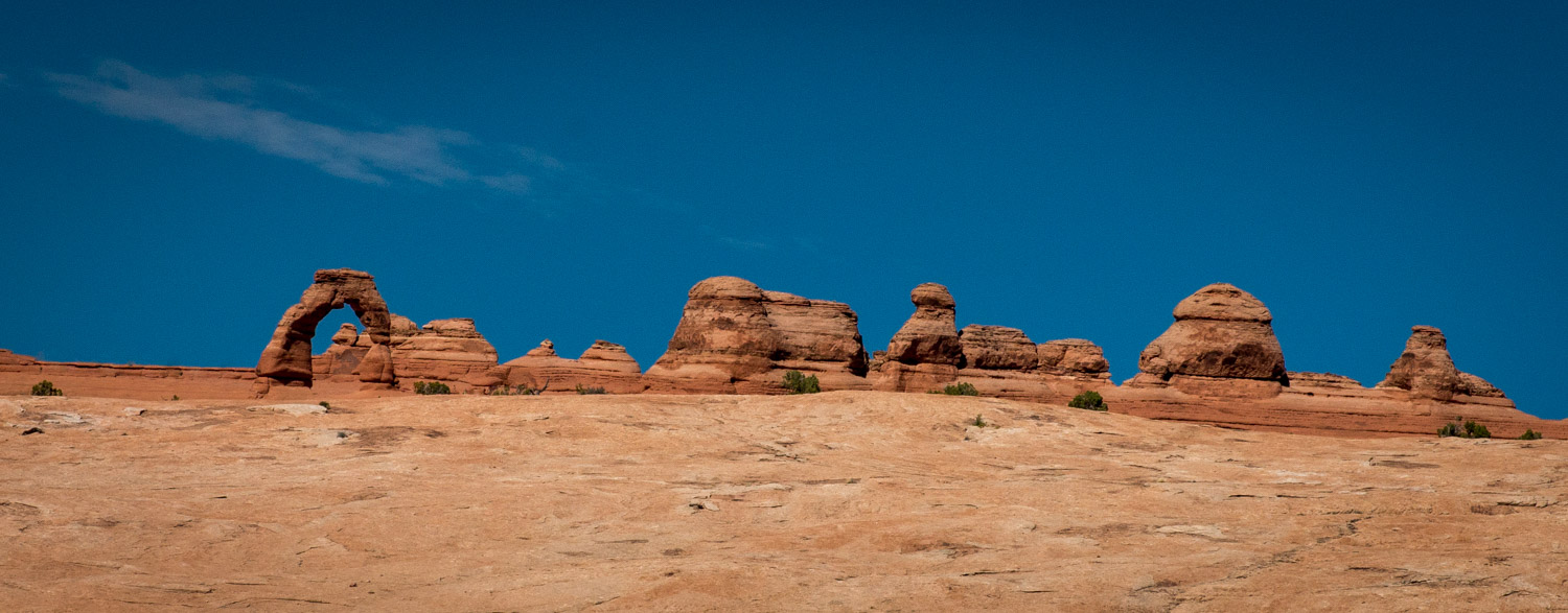
Delicate Arch on the horizon
The evening imaging tasking was performed at a location known as Fiery Furnace. This location will be the site of a “Ranger led” tour in two days that the crew has agreed to participate in. These tours are quite popular with the locals so we shall see what the attraction is. As it turned out the sunset, was not a big attraction. Local meterological conditions provided a hazy, light blue sky that provided harsh glare, hard shadows, and no inviting colors. The crew is doubtful that on review the evening’s imaging task will be recorded as “successful”.
Balanced Rock
Log transmission ends. Standby for future log segment...